I learned a long time ago that when a Texas rancher tells you the main house or hunting camp is just a short piece down the road from the main gate, take his advice with a grain of salt.
My two grandsons and English wildlife artist Andrew Warrington were sure that I was lost as I drove mile after mile on the narrow, rough and rocky two-track through the inhospitable Texas terrain in the Stygian blackness. Half a dozen miles after leaving the main road we pulled up to the double wide trailer that was to be our predator calling base camp on the 20,000-acre ranch for the next few days, right where I knew it would be, much to the amazement of my companions.
I explained to my compadres that I had known for several weeks that our landowner host wasn’t going to be able to join us and act as guide for the first few days. However, I had remedied that situation by going online and ordering several very detailed satellite aerial photos of the humongous 30-square-mile ranch from MyTopo, which gave me a very good idea of the layout of the ranch and some key locations to start our calling venture.
MyTopo provides a quick, easy resource for hunting and various other outdoor mapping needs and I have used their maps and aerial photos for a number of years. They offer a “free” browsing service where all you need to do is type in a geographic feature such as city, town, mountain, lakes, etc., and the system locates and pulls up that area. You can then scout the area by switching between topographic map view or satellite image view and get an exact latitude and longitude for a pinpoint location such as waterhole, blind or stand location. You can download this precise info into a GPS device or your smart phone navigation app that can bring you right to that location in the field. Some MyTopo services are free or you get an online subscription for unlimited downloads or to purchase high quality printed maps for use in your office or in the field.
You can order low cost aerial images that are less than three years old produced by the Department of Agriculture for detailed up-to-date satellite images, or you can order more detailed maps and photos by Digital Globe that are a bit older but allow for more definition on smaller areas.
I have made good use of maps and aerial photos for all types of hunting, including predator hunting in many western states on public BLM and USFS lands as well as for private land hunting across the country. We make extensive use of them on our private deer hunting leases in the Midwest. The satellite image aerial photos can be had with landowner names and property boundaries, which is a real boon when pre-planning a predator hunting venture or actually hunting and calling in a new area. These maps or photos can be ordered on tough waterproof paper for field use or on laminated paper for office use with a dry marker.
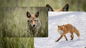
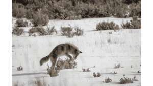
In perusing the aerial photo on the aforementioned Texas ranch, it was easy to pinpoint a flattop bench that overlooked a brush- and mesquite-choked creek a quarter mile below the camp. There was another enticing looking bench with a view of a lot of prime predator habitat a half mile below that, as well as several open saladilla flats bordering some dense whitebrush thickets on the back corner of the property. The first two stands of the morning netted four coyotes and the next four stands picked out on the map without ever having been there netted two more. Six coyotes and several misses from stands, on a ranch I had never hunted before all chosen from a satellite photo.
There are a number of hunting apps available online for your smartphone that you can use in the field while you are actually hunting. These apps can and will help make you a more effective predator hunter. I have made use of onXmaps.com and Scoutlook and, while most are designed primarily for big game hunting, they can be utilized for predator hunting and calling as well.
One of the most useful features of several of these apps for predator hunting is the GPS locator that shows precisely where you are and the real-time weather and wind situation for that particular location. The apps that show wind direction and the hunter’s scent dispersal pattern via a cone-shaped overlay are especially helpful and educational for predator hunters. This allows them to hunt just a bit smarter and thus more effectively. Don’t think I’ve given up my trusty talcum powder bottle, I’ve used it a number of times predator calling and spot-and-stalk predator hunting and it still works very well.
High tech has certainly added a whole new dimension to predator hunting, and scouting from above certainly allows a predator hunter to hunt more effectively. However, you can bet predators are still gonna win their share of the encounters, and that ain’t all bad!