Acquiring quick knowledge of properties around you while scouting on-the-go is essential. This is especially true in the middle of farm country, which is often dotted with a patchwork of fields and woodlots, with numerous landowner fences joining at the corners. Modern hunting apps can help sort out who owns what. The best include everything from property ownership details to hunting aids that add graphics, plus scouting notations to satellite imagery.
onX Maps
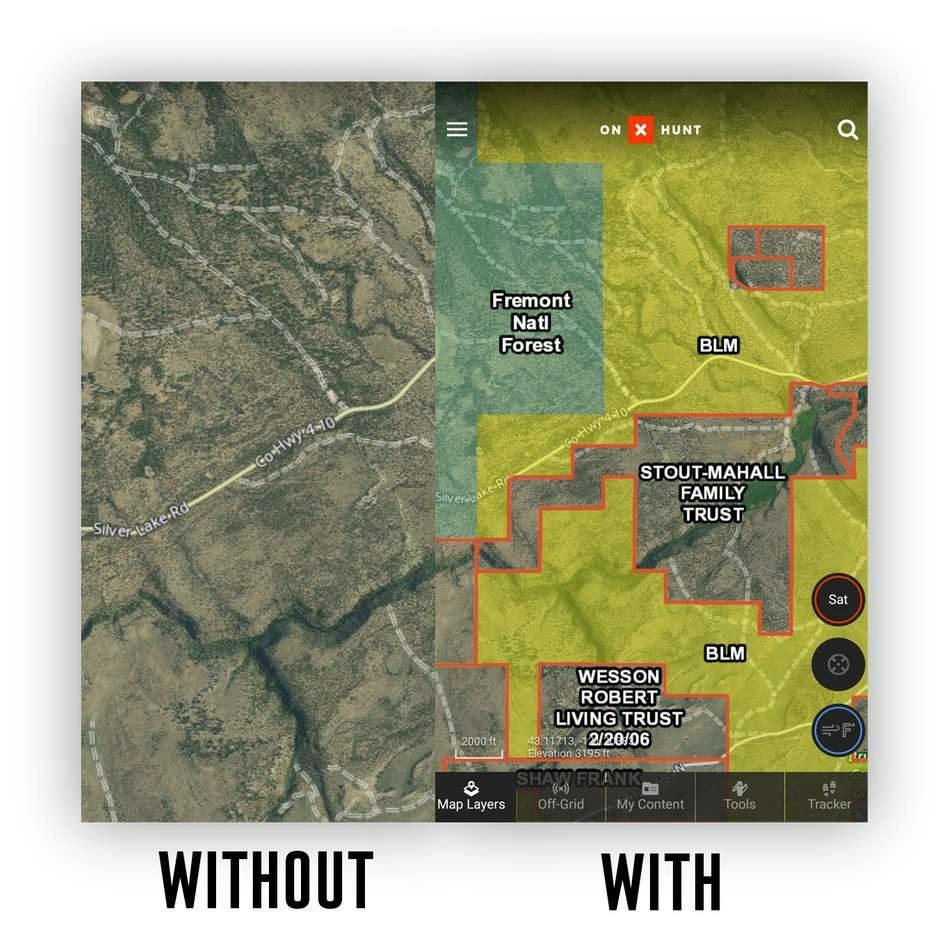
One of the leaders in property ownership information is OnXmaps (photo above). This pioneering company offers access to property ownership, hunting unit information, topography and aerial imagery. Information can be accessed via cellular service or downloaded. Garmin GPS, Apple, android and home-based web platforms all offer accessibility. You can have access anywhere simply by saving the maps you need to your device regardless of cellular blackouts.
CONTACT: www.onxmaps.com
ScoutLook Weather
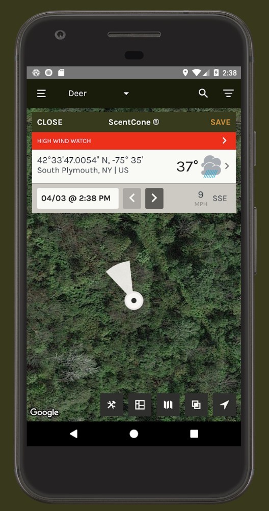
Another innovator that includes additional hunting aids is ScoutLook Weather. Created originally as a weather aid to hunters, the company has been improving the app with additional support elements for all hunting aspects. The app includes exceptional, pinpoint weather forecasts that include unique graphics to show your scent dispersion with current wind direction (right photo). The app allows you to mark important sign with the ScoutMarX feature to mark trails, roads, camp, food plots, scrapes, blood trails and more right on the image. Use the ScoutLook logging system to keep track of game animal activities and you can even share your findings with friends via the app. For scouting and property ownership details the app includes overlays with topography features combined with the new Property Lines feature. Tap on the interactive map to see property lines, property sizes, landowner information and other helpful property details. Save locations and you’ll have access to offline viewing even without cell service.
CONTACT: www.scoutlookweather.com