<< Continued From Part 1: Benefits Of Map Reading
Map Reading 101: Woods, Water, Ridges, Saddles
 Topo maps provides hunters the ability to more effectively conduct in season scouting on new properties, while keeping their disturbances to a minimum. |
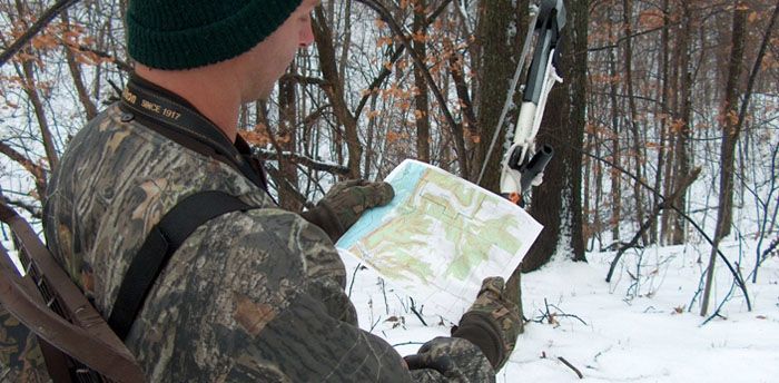
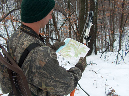
United States Geological Survey’s (USGS) 7.5 minute quadrangles (quads) are the basis for most topo maps. The USGS has quad coverage for all of the United States. Luckily, in today’s computer age, there are several sources that offer printable versions for free, as well as numerous companies offering maps for sale. Because of USGS quads being so widely used, I’ll use them as the standard for our exploration into map reading.
Lets begin by exploring are cultural features. USGS quads illustrate cultural features, such as roads, railroad tracks, buildings and major transmission lines, in black. This information alone can help set the stage for how to gain access to areas and even possible routes to stand sites.
Next, we have the wooded areas that are shaded in green. Aside from that obviously showing us where the woods are, narrowed down necks of green can show potential funnels.
The hydrological features, such as swamps, rivers, lakes and ponds, also can show funnels. The narrow piece of dry land between those bodies of water could be a good example of that. Rivers and streams often are used as travel corridors for deer. They can serve as excellent low impact routes to stands. That swamp is a potential bedding area. Finally, any hydrological feature can create barriers that many other hunters may avoid.
For whatever reason, many hunters are unwilling to put on a pair of waders or jump in a canoe to go deer hunting. This often results in mini sanctuaries existing within areas that are heavily hunted. Studying a map can show where these areas exist.
As helpful as seeing a bird’s eye view of those features can be, seeing relief often is the greatest advantage contour maps provide. Each contour line on a map indicates a line of equal elevation, with a standard contour interval of 10 feet on most quads. That means if the 1250 foot contour is running along the side of a hill, the next contour going up the hill will represent the 1260 foot line, where as the one going downhill would be the 1240. Although this does show us how far above sea level things are, the real purpose for hunters lies in showing relief.
Because contour lines are lines of constant elevation and are at set intervals, they show how relatively flat or steep the terrain is. When the contours are spaced relatively far apart, the terrain is fairly flat. Conversely, the closer they are together the steeper the terrain. With this understanding we can begin to see topographical features emerge.
One of the most basic features is a ridge. With contour lines on both sides stacked close together, increasing in elevation as they reach the top, a ridge is easily identifiable. In wooded areas, these ridges often serve as natural travel corridors for deer. Typically, the family groups will have a worn trail on top, with fainter trails just off the sides that are used by bucks. During the rut, it is not uncommon for bucks to run ridge systems for miles, while searching out hot does.
When a major ridge splits, the point before it breaks into two is also a good location. Because bucks are likely running the ridge hard, this point is almost like the intersection of two highways. When setup right, a hunter can cover the bucks running all three portions of the ridges, as well as those switching from one to another.
When the contours bulge out to the side of the ridge it indicates a knob. When small, minor ridges shoot off the side, they show points. Wooded knobs and points are often used as bedding areas. Bucks tend to select the ones that allow them to use their eyes to see the low land below and the wind to cover their backside. That combination provides bucks with the ultimate in safety.
Ridges pair with other features to create many different topographical funnels. For example, a saddle is nothing more than a dip in a ridge. If a person were to look at the profile of a saddle, they would see the top of the ridge running fairly horizontally. At some point, the top of the ridge would dip downward, only to rise back up and continue the ridge. It can be thought of almost like something has taken a huge bite out of the top of the ridge. The bottom of the dip is considered the saddle.
The location where the contour lines running along the top of the ridge wrap around to the opposite side of the ridge is the tapering end of a ridge. When that happens, only to have the contours start upward again, we have a saddle. On the map, it resembles two ridge tops in the process of converging and melting into one. As a side note, both the tapering end of a ridge and the high sides of saddles are also potential bedding sites.
Because a saddle is lower than the ridge top on either side, deer often cross the ridge in the saddle. Simply put, they are lazy and don’t want to expend extra energy unless there’s a good reason to.
Next Part 3: Map Reading 101: Cuts, Benches, Dips, and Gullies
Courtesy Steve Bartylla
Want To Know More?
Bowhunting Tactics That Deliver Trophies ($30) and Advanced Stand Hunting Strategies ($22.50) delve deeply into critical details you must address to consistently arrow the big boys. For an autographed copy ($50 when ordered together), send a check or money order (shipping & handling already is included) to:
Steve Bartylla
1406 St Joseph Ave
Marshfield, WI 54449
Include your name and shipping address.